

GTR-102 · Michigan, US
Mitchell Creek Meadows Nature Preserve - Overlook
By Grand Traverse Regional Land Conservancy
194 photos from 138 people · Since Nov 2023
About this place
Once a golf course, the habitat here is undergoing restoration as GTRLC’s staff and volunteers remove invasive plants and plant native perennials, trees and shrubs. Meanwhile, a collaborative watershed restoration effort is underway to improve water quality in the Mitchell Creek watershed. Help GTRLC montior the progress of restoration work at Mitchell Creek Meadows: The Don and Jerry Oleson Nature Preserve through the use of crowdsourced timelapse photography.
About Grand Traverse Regional Land Conservancy
For nearly three decades, the Grand Traverse Regional Land Conservancy has protected and cared for the region’s natural, scenic, farm and forest lands.
With the support of individual donors, foundations and volunteers, and the partnership of local, state, and federal agencies, we have protected nearly 46,000 acres of land more than 150 miles of shoreline along the region’s exceptional rivers, lakes and streams.
Fully accredited by the Land Trust Alliance, the Conservancy is a 501(c)3 non-profit organization with our own by-laws, policies, board, budget and staff. Our service area includes Antrim, Benzie, Grand Traverse, Kalkaska and Manistee Counties.
We focus our land conservation efforts on protecting crucial wildlife habitat and corridors, critical watersheds, unique high-quality farm lands, valuable forestland and ecologically significant dunes along Lake Michigan’s beautiful and endangered shore. We protect land in several ways:
- By working with landowners to permanently protect private land through voluntary conservation easements
- By acquiring high quality natural lands by purchase or donation to create Conservancy owned nature preserves, which are open to the public
- By assisting local units of government in creating or expanding public parks and natural areas that result in enhanced public access to nature and improved recreational opportunities
- By providing technical assistance to local units of government with the administration of farmland protection programs
We think about the area we serve in terms of watersheds, coasts, scenic transportation corridors and vital clusters of our region’s working farms and forests. By considering our community in this way, we are able to evaluate how certain land uses and protection efforts will impact the things our community values – access to our majestic shorelines; opportunities for hiking, birding, canoeing, biking, fishing and other outdoor activities; safe, clean water; respect for private property rights; and a healthy economy.
Our land protection experts use a variety of conservation tools to protect significant natural and working lands. Our stewardship team documents natural and man-made features on protected land, monitors over 200 conservation easements and maintains nearly 40 nature preserves. Our fund development and outreach teams creatively build relationships with individuals and foundations to secure the resources necessary to protect water quality, natural lands, working lands, scenic views, and places where people can enjoy nature. On every level, our work is supported by hundreds of volunteer colleagues.
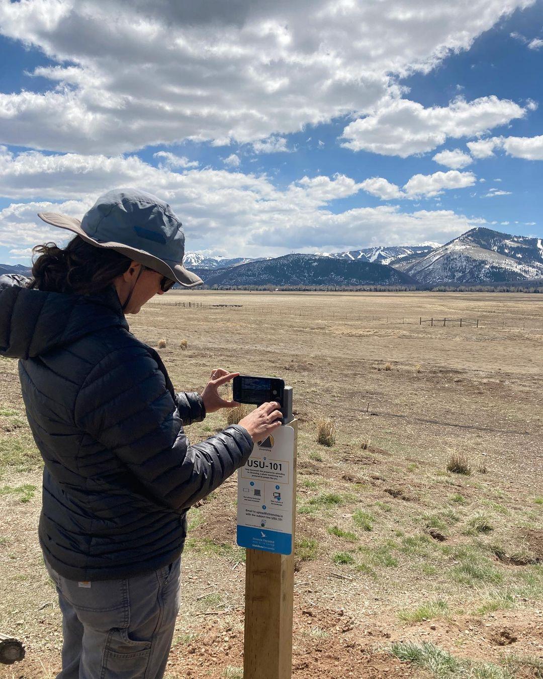
New to Chronolog?
A timelapse made by visitors
People passing through set their phone in the bracket and take the same photo. We line them all up into one timelapse of this place.
See how it worksVisit
Find this Chronolog
Michigan, US · 44.72746, -85.54772
More from Grand Traverse Regional Land Conservancy
Other places they’re watching.


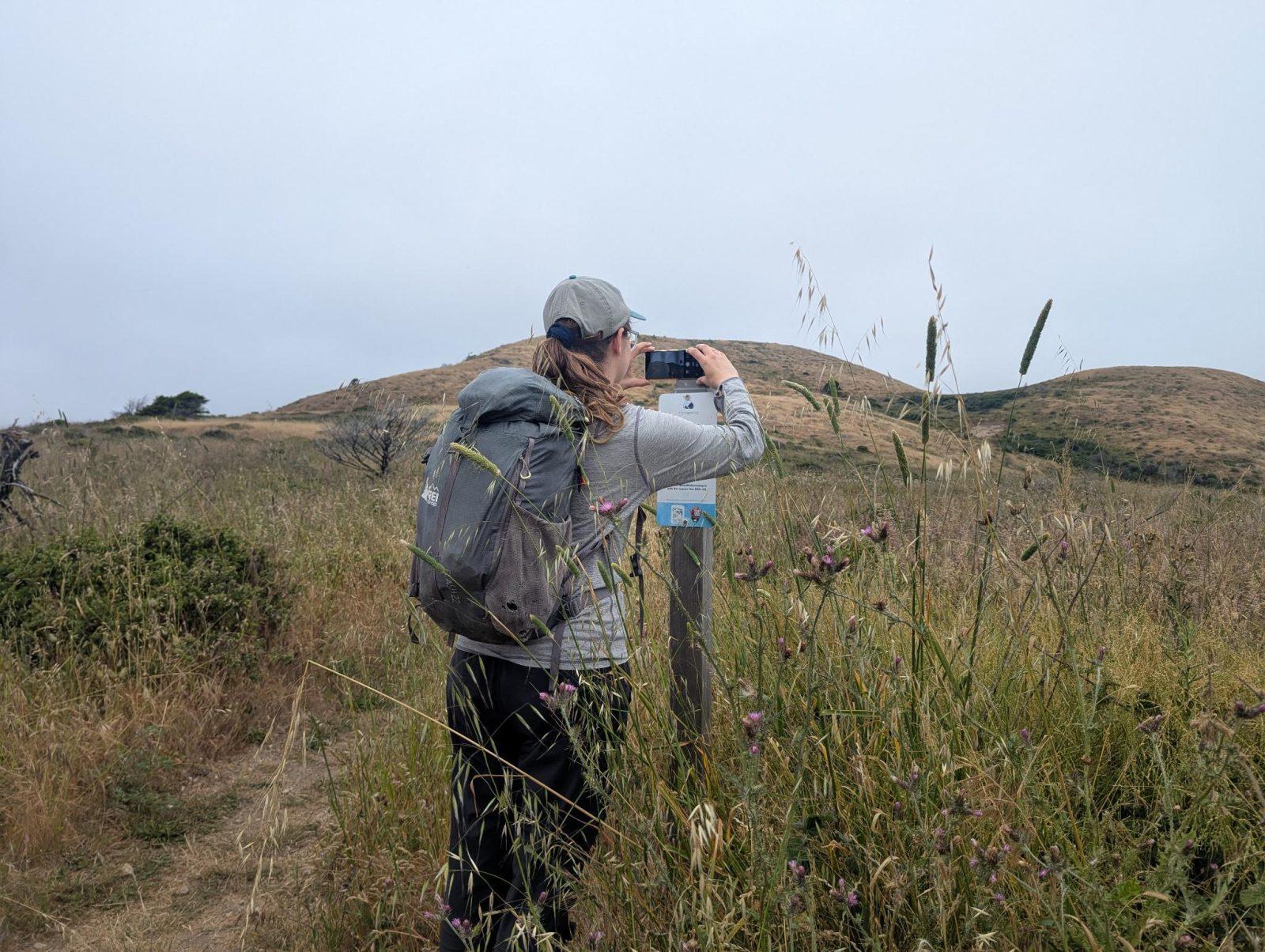
For parks, nature centers, land trusts, schools & more
Give your place a memory.
Each person who stops adds a photo. Together, they show how your site changes.
- Up in an afternoon
- No power or Wi-Fi
- Full-resolution photos and video