2023
2024
2025
2026

2023
2024
2025
2026
Hacker's Hill Preserve
Managed by Loon Echo Land Trust
Since Jun 2022
In Maine, US
LET101
This chronolog combines 152 photos from 130 contributors. Learn more
About this site
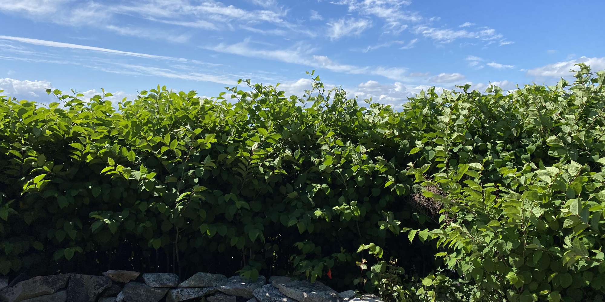
Hacker's Hill Preserve. Photos taken at this observation post location will help LELT monitor recovery of an area from invasive Japanese Knotweed back to native species. This site also captures the evolution of grasses and wildflowers in the fields at Hacker's Hill, we hope to see a return of many beneficial native species to the fields over time. Finally, this site captures the hills and forests of Casco and Naples, allowing us to see changes in area land use over time.
Learn More about Invasive Species.
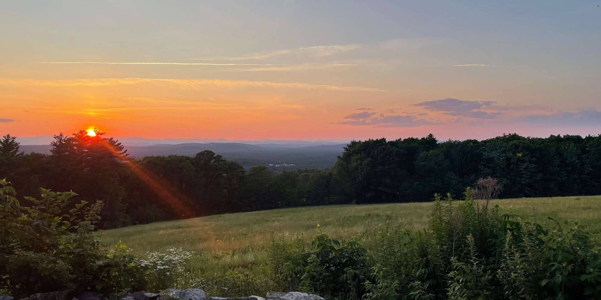
Hacker’s Hill Preserve, located on Quaker Ridge Road in Casco, is 27-acres of fields and woods that provides 360-degree views of the White Mountains, Pleasant Mountain, and the Lake Region.
From May to the end of October the gate is open to vehicle traffic (M, W, F, Sat, Sun) and easily accessed via a paved roadway leading 753 ft above sea level to the top of the hill. The hill has a restroom, picnic tables, and open fields perfect for walking, kite flying, nature observation, picnicking, sunset watching, photography and more.
About Loon Echo Land Trust

Loon Echo Land Trust is a non-profit organization that protects land in the Lake Region of Maine to conserve its natural resources and character for current and future generations. To date, LELT conserves 9,300 acres of land and maintains and protects public access to many iconic outdoor spaces such as Pleasant Mountain, Hacker's Hill, and Bald Pate Mountain. In addition to protecting land, LELT maintains over 35 miles of recreational trails and hosts a variety of guided hikes and educational programs throughout the year.
Loon Echo Land Trust is part of Momentum Conservation's Climate Change Observatory Network, a photo monitoring program designed to work with environmental organizations and communities to assist with the observation, measurement, and documentation of long-term climate change trends and climate adaptation projects.