2023
2024
2025
2026

2023
2024
2025
2026
Rocky Branch Greenway Beaver Dam
Managed by North Carolina State University
Since Feb 2023
In North Carolina, US
MEA101
This chronolog combines 833 photos from 174 contributors. Learn more
About this site
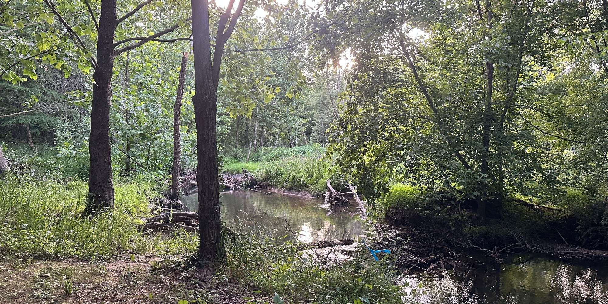
In October 2022, one or more North American beavers (Castor canadensis) migrated up Rocky Branch from Walnut Creek. They constructed a dam across the creek at the site of an earlier stream-restoration project.
Rocky Branch is a first-order headwater stream of the Neuse River basin. The 3.0 square kilometer basin above the beaver dam drains much of the main campus of NC State University between Hillsborough Street and Western Boulevard. The catchment responds quickly to precipitation events because of its small size and the high percentage of impervious surfaces (e.g., roads, parking lots, and buildings) across the NC State campus. As a result, the stream's discharge increases rapidly during rainfall. Heavy rain events often partially breach the beaver dam, decreasing the upstream pond level. After such events, the mostly nocturnal activities of the beaver(s) are readily apparent the following day as they work to repair the dam.
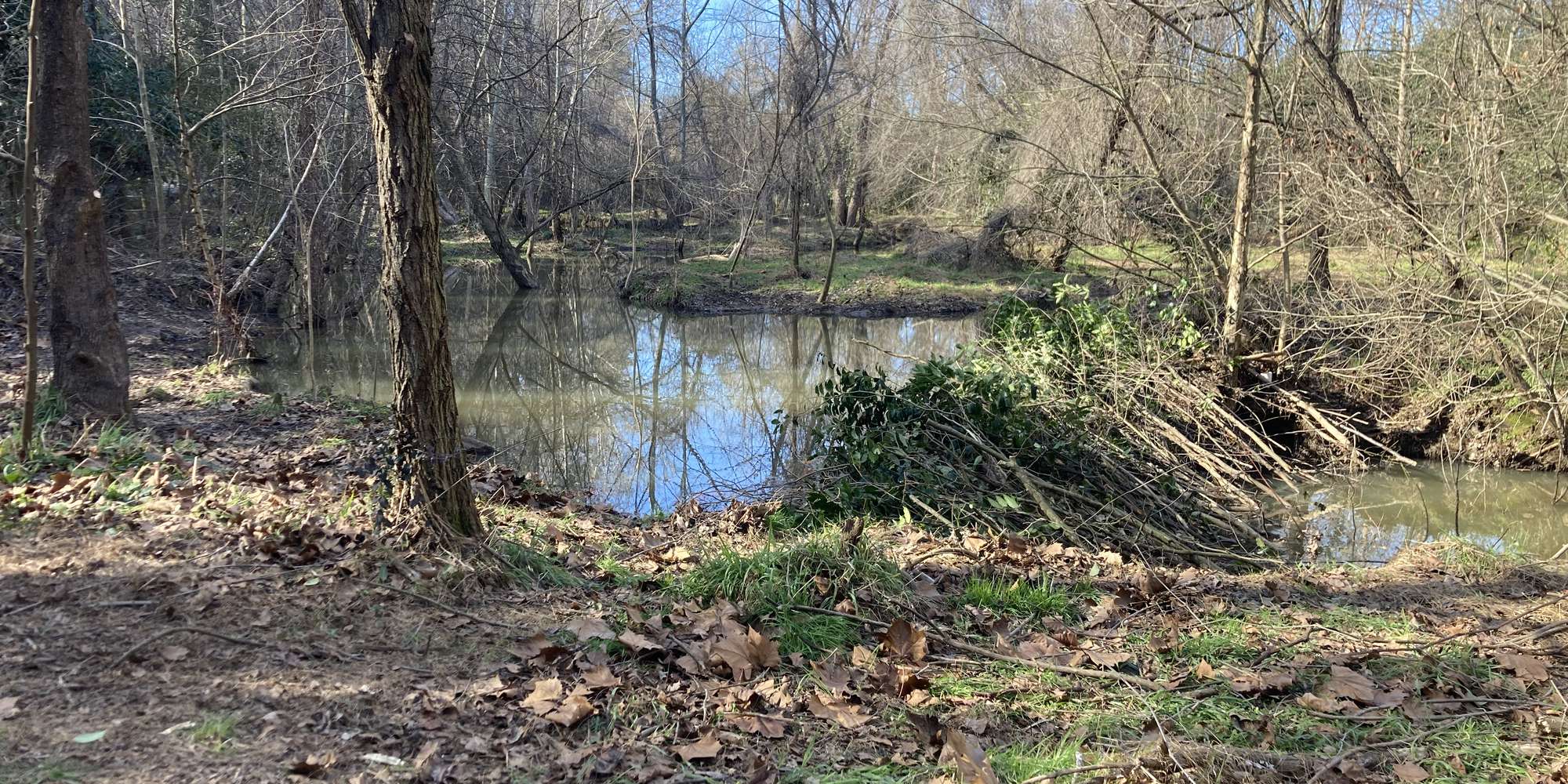
However, on February 4, 2024, exactly one year after the establishment of this Chronology station, faculty and students from the Department of Biological and Agricultural Engineering installed a pond-leveling device called a “beaver deceiver.” The leveler limits the pond's water-surface elevation to protect prior stream-restoration efforts from beaver-enhanced flooding. The pond leveler was damaged by a flooding event on the evening of June 30, 2024, and ceased to function. It was subsequently removed from the stream around July 24, 2024. Between late July and late September, there was minimal beaver activity at the site. With the return of fall weather, the beavers began rebuilding their dam on the 29th of September. A beautiful winter scene with snow on the floodplain and a small amount of ice on the beaver pond was observed on January 22, and again on February 19, 2025.
By spring 2025, high-flow events repeatedly damaged the dam. By late May, the beavers apparently took a vacation, deciding not to fix their dam after the 26th day of the month. Although there was no beaver activity observed during the 2025 summer months at the Chronolog station, large floods dislodged bankside trees; one of these is visible moving past the Chronolog station during subsequent high-discharge events between July 11 and August 16, 2025. With the return of fall, the Rocky Branch beavers restarted construction of a new dam at the Chronolog site shortly after November 9th.
The U.S. Geological Survey operates a real-time stream-monitoring station approximately 200 feet downstream of the Beaver Dam that records stream stage, discharge, and precipitation. It is available here .
In addition, the U.S. Geological Survey also maintains two real-time groundwater monitoring wells about 200 feet upstream from the beaver dam, adjacent to the Greenway Path. The depth from the ground surface to the water table is available for regolith well #1 and bedrock well #2 . Water levels in the wells track precipitation, stream discharge, and beaver activities. When the beavers increase the height of their dam on Rocky Branch, the water levels in the wells also increase. Well-water levels decline when the beaver dam is reduced in height following a flood event.
Faculty and students in NC State University’s Department of Marine, Earth, and Atmospheric Sciences maintain this Chronolog Station. We are studying beavers in urban streams around the greater Raleigh area. We are interested in the physical and biological changes in urban streams following the establishment of beaver dams and their potential to improve the physical, hydrologic, and biological function of human-modified and impaired streams.
We have established a sister iNaturalist project to collect observations of the flora and fauna associated with the NC State campus beaver pond reach of Rocky Branch. If you are an iNaturalist user, consider the NC State Campus Beaver Pond project.
Thank you for reading about this Chronolog site and contributing your photographic observations. We encourage repeat visits to assess how the reach of Rocky Branch changes following rainfall events and with the seasons.
Please contact Karl Wegmann, Professor of Geology and Geomorphology at NC State University, at kwwegman@ncsu.edu with any questions or comments.
About North Carolina State University
Dept. of Marine, Earth, and Atmospheric Sciences at NC State.