2022
2023
2024
2025

2022
2023
2024
2025
Woodward Fire Photomonitoring Site 5
Managed by Point Reyes National Seashore Association
Since Feb 2022
In California, US
PRS105
This chronolog combines 336 photos from 307 contributors. Learn more
About this site
An early burn site photo from March 21st, 2021.
In hiking or riding to this photopoint, you may notice that you’re many miles away from the nearest road or building. Most of the Woodward Fire burned within the 33,373 acres of designated Wilderness within Point Reyes National Seashore. The Phillip Burton Wilderness was designated in 1976, to provide an extra layer of protection for the most remote areas of the seashore, to forever preserve its wild characteristics.
For many years, managers for public lands such as National Parks, National Forests and designated Wilderness Areas chose to suppress all wildland fires, fearing their destructive capacity and looking only at the losses rather than the gains. Left unburned for decades, many areas of California are now subject to extremely hot, fast-spreading fires that devastate natural and man-made environments, rather than the more frequent, low-heat fires that occurred regularly before Western settlement, and which were often set intentionally as part of indigenous land management practices to promote a healthy environment.
Thanks to years of research and wisdom shared by California’s many indigenous peoples, public lands agencies now attempt to manage fires in a similar way that is best for the ecosystem. While many Wilderness areas across the country choose not to suppress naturally (lightning) ignited fires, due to their many benefits, the Fire Management plan in Point Reyes states that all fires must be managed and controlled because of the Seashore’s relative proximity to nearby communities. It took a lot of work and many resources to control the blaze, but the outcomes of the Woodward Fire were largely positive! According to a report by National Park employees, “The Woodward Fire burned with mixed severity across a matrix of coastal habitat types that have seldom burned in recent decades but are largely fire tolerant or fire adapted. The result of the return of fire as an ecological process to the Point Reyes landscape could be a mosaic of vegetation communities more heterogenous, resilient, and diverse than before.”
About Point Reyes National Seashore Association
Located just north of San Francisco, the Point Reyes National Seashore spans 110 square miles of coastline, rocky headlands, expansive sandy beaches, open grasslands, brushy hillsides, and forested ridges. Point Reyes offers visitors over 1500 species of plants and animals to discover across a variety of habitats and designated wilderness areas. Home to several cultures over thousands of years, the Seashore also preserves a tapestry of stories and interactions between people and their natural surroundings.
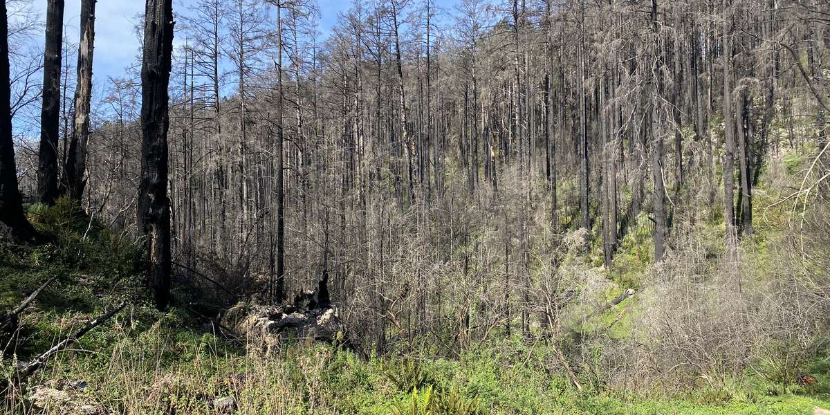
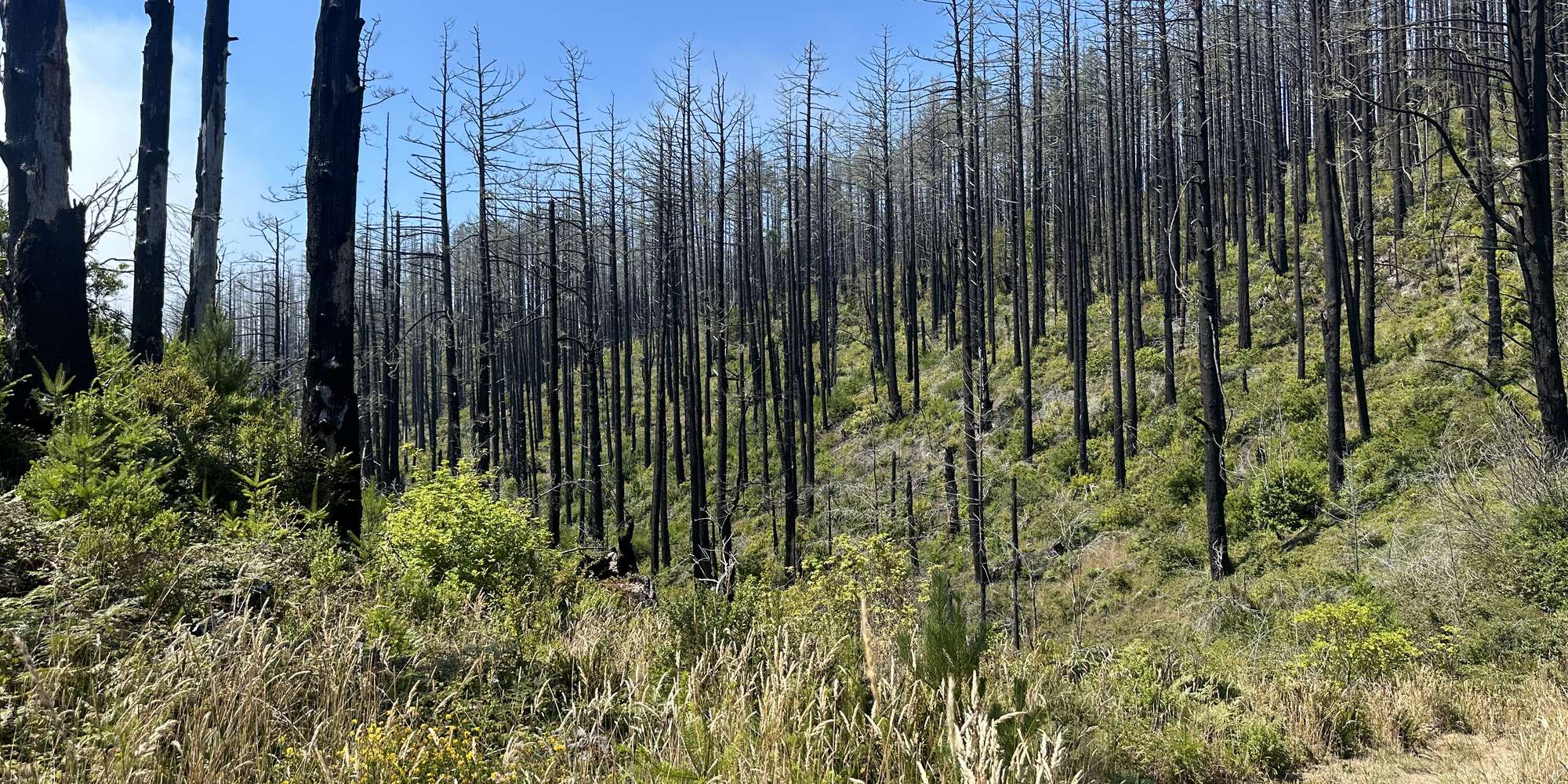
On Monday, August 17, 2020, a lightning storm sparked a wildfire within Point Reyes National Seashore which was named the 4-5 Fire, north of the junction of Woodward Valley Trail and the Coast Trail. On Tuesday, August 18, a second lightening ignition was located nearby, originally named the 4-6 Fire. Aided by gusty winds, these fires soon combined to form the Woodward Fire, which quickly grew in size. Various resources from across the country and state were called in to help control the blaze. By Thursday, October 1, 2020, the Woodward Fire was 100% contained at 4,929 acres in size, but not declared officially out until Tuesday, January 12, 2021.
All told, park scientists and managers largely consider the Woodward Fire to be ecologically beneficial because it had a mix of burn severity. Periodic wildfires are a common feature of many California ecosystems, and many native plant communities are adapted to tolerating or even requiring occasional fire events for reproduction and regeneration. The vast majority of parklands within the fire’s footprint received a low or moderate burn, which can lead to healthy fuel reduction and improved habitat for many native species. Other tracts of land sustained a more severe burn, and these areas may take longer to recover from the event.
Your photo contributions will help park scientists track re-growth in the Woodward Fire zone and answer questions about plant and animal habitat recovery following the fire.
The Woodward Fire Recovery Monitoring Project is a joint program of the Point Reyes National Seashore Association and the National Park Service.
The Point Reyes National Seashore Association (PRNSA) was formed to help the National Park Service preserve and enhance the Point Reyes National Seashore’s natural, cultural and recreational resources. As the park’s primary nonprofit partner, we raise funds to support critical resource preservation projects and offer year-round environmental education programs that engage the public in accessing, enjoying and understanding Point Reyes National Seashore.